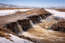
Residents of the village of Naberezhnoye, Denisovsky District, Kostanay Region have lost transport links after the only road was flooded. Due to flooding, it has become impossible to leave the settlement, effectively isolating the village. According to residents, this situation occurs every spring.
WHAT HAPPENED
According to Tobolinfo.kz, the flooding of the road has completely cut off access to the village: there are no alternative routes, as the surrounding areas are also under water.
Local residents note that the situation repeats itself every year. This year, the road has gone completely underwater, making it impossible to leave the village in any direction.
According to villagers, repairs were carried out on the stretch last year. However, residents claim the work was done 'hastily' and did not prevent further flooding.
LOCAL AUTHORITIES' POSITION
The akimat of Denisovsky District stated that the flood situation is expected and is under control.
"At present, there is no threat to the settlement, and an alternative road is operational for emergencies. The situation is under around-the-clock control of the local executive body and emergency services," the authorities explained.
CONTEXT
Spring floods annually cause road flooding in various regions of Kazakhstan.
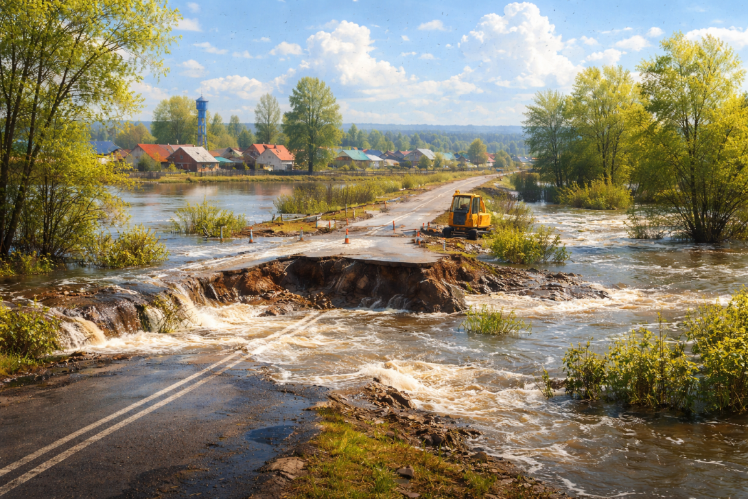
Previously, a similar incident occurred in the Zerenda District of the Akmola Region, where meltwater destroyed a section of road near the village of Iglik.
Against the backdrop of the current situation, ahead of the peak of spring flooding, the Pavlov Analytical Centre, in partnership with the companies Geobox and Giscarta, has presented a tool for monitoring water threats. This involves an interactive map for forecasting floods in spring 2026, which allows users to visualise risk zones using a colour scale.
A video review of the map is also available on YouTube, detailing the forecasting principles and the possibilities for using the tool.