The interactive flood forecast map service for spring 2026 was temporarily unavailable due to a DDoS attack. The incident occurred during preparations for the peak of the high-water season, making the tool's unavailability critical for users.
WHAT HAPPENED
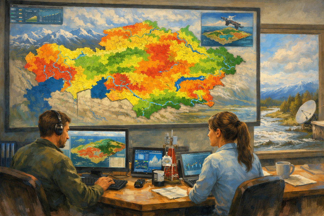
According to the Pavlov Analytical Centre ‘Pavlov Analytics’, a service developed jointly with Geobox and Giscarta was attacked overnight. As a result, users were temporarily unable to access the map, which displays risk zones using a colour scale.
HOW DEVELOPERS RESPONDED
Partners from Giscarta began addressing the aftermath of the attack as soon as it was detected. Apologies were issued to users for the temporary inconvenience. At the time of publication, the service has been fully restored, and access to the map is once again open.
WHY THIS SERVICE IS NEEDED
The interactive flood forecast map for spring 2026 was unveiled against the backdrop of preparations for the active high-water period. The tool allows users to visualise risk zones and can be used to assess potential water-related threats.
Users can also access a video overview of the map on YouTube, which explains the map's principles of operation and its functional capabilities.