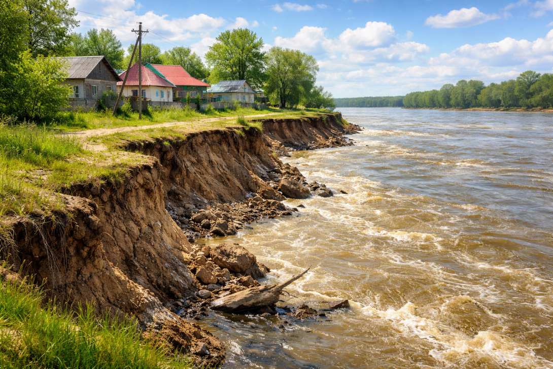
Residents of the village of Praporshchikovo in the East Kazakhstan Region (EKR) report ongoing erosion of the Irtysh riverbank, which has now approached residential houses. According to them, the situation repeats every year.
WHAT HAPPENED
As villagers report, with the rise in the water level of the Irtysh, active bank erosion began, reports Altainews.kz.
As a result, the cliff edge has noticeably moved closer to residential houses.
Local residents fear that with a further rise in water, the erosion could affect buildings.
WHAT LOCAL AUTHORITIES SAY
Yerlan Zhumagulov, Akim of the Irtysh Rural District, stated that the situation remains stable and there is no threat to the population.
According to him, about 520 metres of the bank were reinforced last year. Additional work is planned once the water level in the river decreases.
RESIDENTS' REACTION
According to the villagers, the problem has been occurring for several years.
"It's 5-7 metres to the high-voltage tower. If it falls into the Irtysh, it will be an environmental disaster; if it falls on the village, it will mean loss of life," wrote one user of the social network Threads.
The villagers note that the distance from the cliff to the houses is gradually shrinking, which is causing them concern.
CONTEXT
Earlier, village residents had already reported the gradual retreat of the bank and the risks to residential houses. Incidentally, according to the villagers, back in 2019 they submitted a collective appeal to the akimats of the rural district and the region, requesting bank reinforcement.
Against the backdrop of recurring cases of bank erosion and flood risks in regions of Kazakhstan, attention is increasing towards monitoring and forecasting tools.
The Pavlov Analytical Centre, in partnership with the companies Geobox and Giscarta, has presented a tool for monitoring water threats. This involves an interactive map for forecasting floods in spring 2026, which allows visualisation of risk zones using a colour scale.
A video overview of the map on YouTube is also available, where the forecasting principles and possibilities of using the tool are analysed in detail.