The effects of spring floods have been recorded in several regions of Kazakhstan. In the Akmola Region, a pontoon bridge was flooded, and in the North Kazakhstan Region (NKR), a section of road was washed away. The situation has affected transport links and required prompt action from the authorities.
WHAT HAPPENED TO THE BRIDGE IN THE AKMOLA REGION
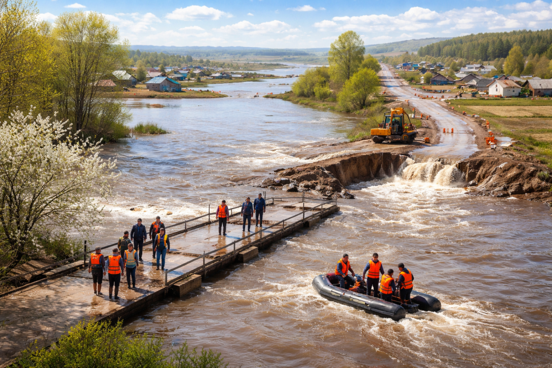
According to the Ministry of Emergency Situations (MES), an overflow occurred over the pontoon bridge on the Shagalaly River in the Zerenda District of the Akmola Region. The structure connects the main part of the village to a street where 28 residential houses are located.
"Despite the availability of an alternative road, at the request of local residents and the local executive body, a crossing was organised on site. Rescuers transported 16 people by boat, allowing residents to get home and buy food," the MES reports.
The MES clarified that the bridge itself remains in good condition, and the water level in the area is dropping. Officials from the akimat, staff of the Department of Emergency Situations (DES), and the police continue to be on duty at the site.
WHY THE ROAD IN THE NKR WAS OPENED
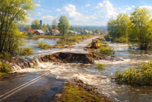
In the Akzhar District of the NKR, a sharp rise in meltwater washed away the road surface on the district road Leningradskoye – Aisarinskoye.
According to the akimat, to prevent further damage, a decision was made on the controlled opening of the road to ensure the unhindered passage of water. After the water level drops, specialists have begun restoring the road embankment.
Around-the-clock duty for staff from the akimat and road services has been organised on the site.
CONTEXT
Floods annually affect certain regions of Kazakhstan, especially during the period of active snowmelt.
Against the backdrop of the current situation, ahead of the peak of the spring flood, the Pavlov Analytical Centre, in partnership with the companies Geobox and Giscarta, has presented a tool for monitoring water threats. This involves an interactive flood forecasting map for spring 2026, which allows for the visualisation of risk zones using a colour scale.
A video overview of the map on YouTube is also available, where the forecasting principles and possibilities for using the tool are discussed in detail.